Sunday, July 31, 2016


We visited Smith Rock State Park in Terrebonne, OR with Katie and Mike today.  It was very convenient to River Rim RV Park (less than 20 minutes).  Being a Saturday, I should have realized there would be quite a crowd.  It was a little difficult to find parking close to the trailhead.  Joani found out later that Smith Rock is a world-famous climbing destination. Just a wild guess, but I would say I saw 50 to 100 climbers as we hiked below the vertical rock faces.

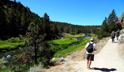
We initially chose an easy hike, the River Trail, that winds clockwise around Smith Rock and ends at Monkey Face.

Asterisks Pass is an easy scramble on the east side, but on the west side, it is not a hiking trail.  SummitPost.org says, the west side "is a 4th class scramble with enough potential for a "damaging" fall to give many a pause."  We didn't even pause, we just continued on the easy River Trail.

I would love to do this hike in the spring and again in the fall.

In some areas across the river at the base of the cliffs, we noticed irrigation sprinklers and farm equipment.  Magnificent homes line the cliffs to the west.

Once Monkey Face came into view, a decision had to be made:  turn around and retrace our steps on the easy trail or go for the gold and hike the Misery Ridge trail to complete a loop back to our starting point.

We went for it and, boy howdy, it was worth it.

The ascent was pretty fast with stairs in places and lots of switchbacks. The climb was so steep that my knees would not want to come back down this way.

Can you tell how the rock got its name?  The climbers are in the monkey's mouth.

We had hiked up and around to the back side of Monkey Face and the view just kept getting better.

One climber was sitting in the mouth of the Monkey with a white helmet on taking in the view.

Not quite at the top, a plateau opens up (Monkey Face viewpoint) making it a great place to pause and take in the view.  Below, the Crooked River wound to the west/north/west (the direction of our campground).

 Looking west/south/west, the Three Sisters make a beautiful backdrop for the valley.

Many of Oregon's Cascade peaks can be seen from this viewpoint.

Katie snapped our picture once we reached the Misery Ridge summit.

What goes up must come down.  Lots of switchbacks in our future.  On the last switchback in the picture above is a small crowd.  A young woman badly twisted an ankle and needed a rescue crew's assistance to get back down.


Almost there, but once you cross the bridge you also have to climb back up the other side to the car parked at the upper left corner of the picture.  Uff da!!!

The ranger was waiting for us to get down to close the trail due to the injured hiker.


I would have liked to ice down my knees after that hike, but I guess it wasn't really so bad. We did, however, return home and guzzled lots of cold drinks to re-hydrate. Something about a tough hike coupled with the sun and the wind and extremely low humidity really takes it out of you - or it could just be we're not getting any younger!

Thursday, July 28, 2016


Before we left Georgia, Joani had contacted our insurance to see about the replacement of our cracked windshield.  As it happened, they could not work out anything before we headed west, but they were able to schedule its replacement in Oregon.  It took a few calls to coordinate the proper piece of glass and once we arrived at River Rim RV Park in Crooked River Ranch there was a slight delay in scheduling the work.  I had no idea how long the replacement would take or how a windshield is installed.


We were both pleasantly surprised at just how quickly the operation went.  From the time they arrived until they left was less than 15 minutes.  Beautiful, clean glass made the whole coach feel like new - I am definitely looking forward to the view on our next drive.


The Crooked River Gorge is probably less than 20 yards from the front of our coach, but to see down to the river we have to walk to the rim. The sheer cliff made me nervous, but I snapped a quick picture peeking over the edge into the abyss.  Maybe later we will hike down to the river.

Saturday, July 23, 2016


Today we headed towards the snow-capped "Sisters" peaks to our west.  We drove through the quaint little town of Sisters and continued west on highway 242.  The grassy fields gave way to impressive forests as we gained altitude.

The "Three Sisters" are host to 17 glaciers encompassing 2257 acres.  They are the largest glacial area so far south in the US.

Suddenly, we came upon massive lava fields.  At a scenic turnout. an informative sign acquainted us with the names of peaks and identified the distinctly different lava flows.  We took a short hike from the road along the boundary line between the forest and the lava.

Belknap Crater, a shield volcano, looked luminous.  It erupted 3,000, 2,900 and 1,500 years ago.  It will not likely blow again.

Mt. Washington is also a shield volcano.  The main peak has been scoured of loose rock and ash by glaciers in the last ice age.

It has a line of spatter cones on its northeast flank that blew just 1,330 years ago.

Fifteen miles further up the road, we stopped at the Dee Wright Observatory.  Not the kind of observatory I usually visit with telescope domes.  This was a place to observe the overlapping lava fields from the many now extinct volcanoes in the area.

The observatory was built by a CCC crew.  It was completed in 1935 and named for the construction crew’s foreman who had died the previous year after serving 24 years as a Forest Service packer and crew foreman.

Carefully aligned portals in the observatory let one identify the visible peaks in every direction.

Each portal had a carved stone label that had not held up well with time.

North Sister, 6.6 miles away, is photobombed by Middle Sister, 7.7 miles away.

In some places, it was easy to visualize motion.

The forest is trying to reclaim the land covered in lava but it is a very slow process.  If only we could look in again in another million years or so.


The lava fields spread out over 65 square miles and are among the youngest in this country.


We worked up a good appetite walking the trails that wound through the lava beds before we all agreed it was time for something to eat. Katie and Mike had explored Sisters before and recommended the Cottonwood Cafe.  Very nice food with the best french fries (Garlic Truffle Fries) we had ever eaten!


We spent a few hours walking around the gorgeous little town of Sisters exploring some of the unique little arts and crafts galleries.


We completed our circuit of the town at a small bakery where we indulged in freshly made doughnuts and coffee before we headed home to Sam and Gray Man (Katie and Mike's cat).

Tuesday, July 19, 2016


Moving day again - this time we joined our daughter, Kate, and her husband, Mike, in central Oregon.  The road never seemed to have a straight mile and it seemed like we were either going uphill or downhill, but we got an early start and it was only 114.1 miles (79,271.0 total) to Crooked River Ranch, OR, so I cannot complain.


We need to explore Smith Rock State Park (right in the pic).

There was a tight turn and steep downhill grade on our final approach to River Rim RV Park, but what a view!

We are down in a valley on the rim of a river canyon.  We're looking forward to some good hiking opportunities.

They set us up in a temporary spot for the night so we will have to move again tomorrow.  It will be but a minor inconvenience considering all of the trouble the campground folks have gone through to accommodate us.  We will get to spend a month with Katie and Mike before we head out to the American Coach Association rally further west in Canyonville, OR.

What a view!

Monday, July 18, 2016


We spent some time cleaning up around the coach and then headed back the John Day Fossil Beds National Monument-Sheep Rock Unit to check out a few more of the areas we previously missed.  First up was the Foree unit.  The dark sky was a nice backdrop for the colorful layers of exposed rock, but first, we had to wait out a quick shower. We were told the color looks best after a rain, so we did not mind the wait.

The rain tends to deepen the colors, but the sun is still needed to bring them out.


We waited patiently for the sun to break through the clouds.  It finally did in quick, but short-lived patches.


A couple of short hikes on the dog-friendly trails took us to several overlooks where erosion has exposed the strange and colorful layers of volcanic ash deposited millions of years ago.


Along the highway, we stopped in front of a house surrounded by flowers.  The lavender color seemed to be a close match for the color in the hills beyond.


I can't even imagine how great it would be to have this view all around you every day! The footprint of the National Park is really very small, most of the area is privately owned and farmed.

Looking up the John Day River at Cathedral Rock.

Cathedral Rock was one of our favorite formations overlooking the John Day River.  The colors were amazing even without the suns help.


Next stop was the Blue Basin.  There was a 3.25-mile loop trail (760 elevation gain) above the basin which I am sure would have been beautiful, but we opted for the much more reasonable 1.3-mile trail dubbed the "Island In Time" (it still had a 220-foot elevation gain).


The Blue Basin Overlook Trail is at least a 3-hour commitment.  We need to work up to that, so we saved that for next time.

The Island in Time trail was just right.  It takes you along the creek bed, so you are looking up at everything.  The Blue Basin Overlook Trail takes you up to the rim so you are looking down from above.

The trail included 13 expanded metal bridges that were very uncomfortable for doggy feet, so Sam had to be carried over each one.


It rained just enough to make puddles here and there in the creek bed.

Green rock makes for green mud.


The layers of volcanic ash have fossilized bones of animals dating back nearly 40 million years.  Each rainfall has the potential to expose a new find, but I was not able to see anything new after today's meager rain. 

We did the trail in cloud cover.  Another hiker told us it was 105 degrees the last time she hiked it.  We definitely counted ourselves lucky.


We sat on a bench at the end of the trail and soaked in the splendor.  The sun broke through and made the colors more vivid.  The trail was washed in sunlight the whole way back.


This has turned out to be a very dog-friendly park.  As long as they stay on the trails, they are welcome.


What a pampered pup!


We called it quits on the hiking around 1:30 and headed back to Dayville with the intention of a late lunch at the Dayville Cafe.  Sadly, they were only open Wednesday thru Sunday so we will have to visit them another time.