I kept thinking our trip from Page, AZ, to Montecello, UT, should have included the stretch of highway (163) through Monument Valley. I decided against it since it was not recommended for 18 wheelers. Joani heard enough regret in my whining that she said "let's just take a little drive today and see what we missed." It's always great when our thinking is in sync.
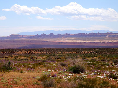
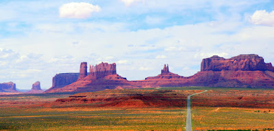
I think the pictures below captured most of the color we saw on our foray into the valley. The desert was nicely in bloom due to recent rains and the clouds were trying to add some drama to our pictures.
When approaching these hills on UT 163, first they take your breath away...
...and then you ask "can that be real?" We caught our first glimpse of them on October 29 of 2014 when we came down the Moki Dugway (UT 261) after doing Natural Bridges National Monument and Muley Point to view the "Goosenecks" created by the San Juan River.
Raplee Anticline is a fold in the Earth's surface that exposes 300 million years of geology.
To view Mexican Hat Rock turn east off UT 163 onto Sjc Rd 2161 just 1.5 miles south of UT 261. It is visible from UT 163, but still easy to miss.
Can you see the hiker standing under Mexican Hat on the left-hand side?
Painted by the natural minerals in the rocks, the hills around Mexican Hat look like abstract art. Known locally as the "Navajo Rug" or "Indian Blanket," the anticline's upfolded and twisted layers of sandstone resemble a rich native tapestry.
The gray limestone of the Paradox Formation is the remnant of a shallow sea environment. The red Halgaito shale is river deposit from an ancient river.
After crossing this bridge in Mexican Hat, Utah, on highway 163, we were glad we didn't take this route with our motorhome last Friday (5/24/2019), it was very narrow. 160 was the better highway for peace of mind, in our opinion.
We finally reached the iconic rock formations that made Monument Valley famous. As we approached, the definition and color just continued to become richer.
It looks like a lonely road, but what you don't see...
...are the hoards of people standing in the road trying to get the same iconic shot with little regard for the cars coming at top speed. (Yes, I'm standing in the middle of the road to get this shot while David grumbles at me.)
From this angle, this looks like one cohesive formation...
...but a little further down the road, this same formation takes on a very different appearance. (I see a chicken in the center.)
Further still and different lighting gives the same feature brighter appearance.
I liked the picture below to give the proper perspective. Of course, at this point, we were still maybe five miles from the nearest approach.
We stopped again on our way home noticing a completely different look due to shifting cloud cover.
When we passed Comb Ridge Anticline this morning it was completely in shadow, but on our return home, it was aglow. Next visit to Utah will require a closer look.


No comments:
Post a Comment