Thursday, July 14, 2016


Thirty-five miles southwest of Jerome was "Balanced Rock".  It was part of a large group of exposed, weathered rock in a scar that cut a swath through the surrounding farmland.  It looks in the picture like it was a high point, but actually, the top of the rock was a little lower than the fields around it.  The entire area was not even visible from the farms nearby.


The top of the Balanced Rock measured more than 40 feet at its maximum and tapered down to three feet at it's narrowest point.  You know one day someone will be there and hear a loud crack and see it fall over. Hopefully, they will not be below it at the time.

A few facts: It is 40 tons of Rhyolite, 48 feet tall, 40 feet wide, and the pivot point is 36 inches x 17.5 inches.

David asked a few questions about the drone buzzing overhead. The owner told us to check out cgwhat.com and then click the "blog" tab.  He would have a video posted later in the day.

If you click on the video you will see Balanced Rock from above.  At 1:48 you can see Sam and me climbing the hill.  At 1:49 David is behind me.  Don't blink, we are out of frame by 1:54.

The adventurous family below decided to climb into the shade of the rock.  They provide a little scale for the strange structure.


Sam was happy to take advantage of the shade whenever possible.

I was a little disappointed to read that the rock's base was reinforced with concrete back in the 1970s to protect it against vandals. 

“Essentially, the Balanced Rock area (along with Twin Falls) was the site of explosive volcanic activity associated with the passage of the North American plate over the Yellowstone Hot Spot,”

“In other words, the Yellowstone volcano was here 8 million years ago and areas such as Balanced Rock and Shoshone Falls record this event,” says geology professor Shawn Willsey

Can you see the dragon climbing up the rock?

I mentioned the rock was surrounded by farmland, but here nothing grows without irrigation.  This is high desert, after all, and very dry. With a giant sprinkler system in every field, the irrigation business must be pretty lucrative.


The trip to Balanced Rock took us through the Snake River canyon again maybe 20 miles downstream from Twin Falls.  The river had a completely different look from a bridge that was probably not more than 30 feet above the water.  There was quite the ambitious highway construction project bringing the road down to the canyon floor.  To the left in the picture below, you can see where they blasted a deep cut in the wall and used the rock for fill under the roadway. 

Wednesday, July 13, 2016


We are staying in the Jerome County Fairgrounds only a few miles from Twin Falls.  I knew Joani had planned to visit several sights during our stay, but I have to say, I was completely surprised by the Snake River canyon.  The entire landscape was flat farmland as far as you could see in every direction to far off mountains in the distance. Then suddenly, you were crossing this giant scar in the landscape.  It was a canyon nearly 500 feet deep with a vibrant green river far below.

The Perrine Bridge is 1500 feet long, the longest span bridge in the west, and 486 feet above the river.  Would you jump off of it for fun?  Not me, but it was fun watching young thrill seekers do it.

The Snake River Canyon was carved out 14,000 years ago by one of the worlds worst floods, the Bonneville Flood.  A lake 350 miles long and 150 miles wide breached at Red Rock Pass and 25,000,000 cubic feet of water per second poured out of the lake headed north toward the Snake River.

The flood followed the Snake River west and enlarged the canyon from 6 to 7 times its original size.  When the flood passed the Twin Falls area the water was higher than the bridge.

The flood drained 1,128 cubic miles of water.  The Great Salt Lake is what is left of the original lake.

The Twins, by David Clemons, dance at the rim of the canyon.


"BASE" is an acronym that stands for four categories of fixed objects from which one can jump: building, antenna, span, and Earth (cliff).  The Perrine Bridge draws many BASE jumpers from around the world. It is the only man-made structure in the USA that is legally jumpable without a permit.

David asked the young men when they planned to jump.  "Within the hour" they answered as they worked on packing the chutes.  We decided to wait.  I can see how they would want them to be just right!

The boys stopped to pet Sam before heading up to the bridge.

There was very little delay between climbing over the rail and jumping. We had trouble catching the action.  If we zoomed in for detail, we immediately lost them on the way down.  If the camera was set for a wide view we had difficulty seeing where the jumpers were and the entire trip down only lasted about 25 seconds.

Are you looking at the guys on the bridge?  Instead, check out the guy falling head first on the lower right.

I wonder what's going through his thoughts at this point.

Two at once, are you kidding?  I'd worry the chutes might tangle!

"They must know what they are doing" is not a safe assumption.  There are no permits or certifications required.  That is part of the appeal - freedom.

They both landed very close to their mark, a small flag several yards from the shore.

A few miles upstream was Shoshone Falls, known as the "Niagara of the West."   With a drop of 212 feet, it is 50 feet taller than Niagara Falls. The water flow today was actually on the low side, but still pretty impressive. Sometimes the flow drops off to almost nothing.

At the right time of year, the water can wrap all the way around to the middle of the photo.

If you are from Idaho, Shoshone is pronounced with a long O and a silent E.

On the way home, I spotted another set of jumpers and quickly stopped at the overlook site on the north end of the bridge.  I caught this guy just a fraction of a second after jumping.


We were crossing the bridge to head back to Jerome when David spotted three more BASE jumpers on their way to the middle of the bridge.  He quickly pulled into the overlook on the other side.  Timing is everything.

BASE jumping is one of the most dangerous recreational activities in the world, with a fatality and injury rate 43 times as high as parachuting from a plane.  Thank goodness today's jumpers all landed safely very close to their mark.

Later in the afternoon, we decided to head back to Twin Falls to explore Centennial Park and see if Shoshone Falls looked better in evening light - it really did not change much.  But we did enjoy the valley from the river almost as much as we enjoyed the river from the rim above.  The bridge made a nice backdrop for photos from Centennial Park making it a very worthwhile visit. 

Centennial Park is a short drive from the welcome center into the Snake River valley.


There were a lot of houses along the canyon rim.  We found one small open spot where we could get an idea of the view they enjoy from their backyards - wow!


Perrine Coulee Falls was clearly unappreciated in its proximity to Shoshone Falls - very few folks seemed to take notice of it as they passed by. There was no parking at the base other than a wide shoulder and no viewing platform or established trails that we could find.  It seemed like anywhere else this would have been considered quite a spectacular attraction in itself.

Perrine Coulee Falls, just off the side of the road, is around 200 feet tall.

As we settled in for the evening a lot of folks were gathering at the fairgrounds grandstands.  You know I had to see what was going on. It was a little rodeo action.  I can't imagine being able to accurately throw a lasso from a horse at full gallop around the head of a steer running full tilt, but most of them did it in around 20 seconds or less.  It's probably a good thing this had no appeal for me because I'm too old to take up a new hobby.

Jerome County Fairgrounds Wednesday Night Roping. Fun and games just a stone's throw from our coach.

Tuesday, July 12, 2016


We left Utah today and headed into Idaho.  Jerome, ID (just a few miles north of Twin Falls) was a comfortable drive of 172.6 miles (78,824.3 total).  A lot of the drive was uphill and the engine temperature ran 160 degrees most of the time and never exceeded 180 degrees.  I think I can safely assume any overheating problems are in the past.

We settled in at the Jerome County Fairgrounds with water and 50 amp power for a mere $10/night.  At the office we were told to park anywhere we wanted.  I chose to face west to minimize sun exposure on the refrigerator.  It probably was not exactly what they had in mind and it looked a bit strange, but we were the only campground guests so there was no problem.  Our location also gave us a nice shaded parking slot for the car. 


It was a beautiful day with a lot of sun, but a high temperature in the mid-eighties - nearly perfect!  Sunset brought some spectacular color to our evening sky to end another great day of full timing.


Monday, July 11, 2016


We had more sightseeing options around Brigham City than we had time, so Joani opted for the Golden Spike National Monument.  I guess I was thinking this was going to be some dry history exhibit and had pretty low expectations.  I was very pleasantly surprised. Golden Spike was one of the more interesting National Park Monuments we have visited.

Sam was with us and even though it was a pretty cool morning we wanted to find him some shade.  There was exactly one tree perfectly situated in the parking area to shade a single spot and we snagged it.

We found out later that Golden Spike was dog-friendly (except in buildings).

As it turned out, we arrived 15 minutes before they were bringing the steam locomotives out.  We were nearly alone as we headed out to the tracks, but a crowd quickly gathered.  I guess I have always had a fondness for trains and these were beauties.  The Central Pacific Railroad was represented by the Jupiter while the Union Pacific Railroad ran Engine 119.  

Central Pacific's Jupiter had a wood-burning engine.

Ranger Matthew said the colors were historically accurate. I'm guessing the road grime left them looking basically black most of the time.

Union Pacific's No.119 had a coal burning engine.


They parked the two locomotives head to head to re-enact their original position at the ceremony celebrating the completion of the first transcontinental railroad.  The celebration included driving a golden spike into the last timber to complete the track.  

The panorama David took blew me away (they are hard to get right).

"East Meets West" Centennial painting of the last spike ceremony by American artist Frank C. McCarthy.

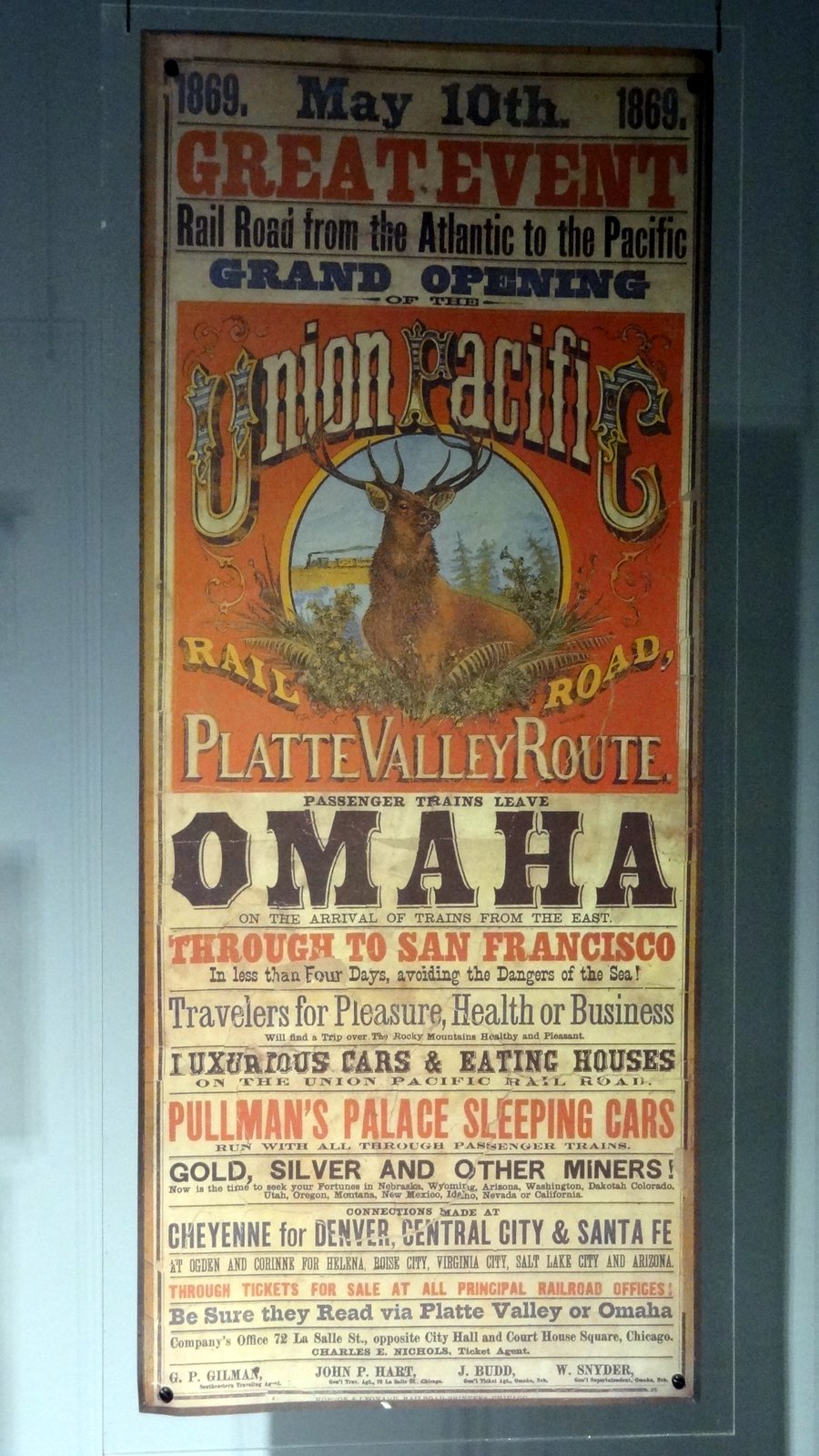
Before May of 1869, the western terminus for all rail lines was Omaha. From there, pioneers intent on continuing westward went by wagon.  It took months of grueling and often dangerous travel to reach the west coast.  Once the railroad was completed, the trip from Omaha to San Francisco could be completed in two or three days in relative comfort and safety.  It gave me a new appreciation for our RV (the modern version of the Conestoga wagon) and the Interstate Highway system.


We both waited and waited for the mamma swallow to swoop in and bring them food, but when she did...

...the little one's reaction was sooo ecstatic I jumped and blurred the shot.  We waited again and just as we gave up she would swoop in.


Salt flats dot highway 83.

Sunday, July 10, 2016


Since we drove so far yesterday, we had a really short drive today - 96.9 miles (78,651.7 total) to Brigham City, UT.  I was a little worried we would arrive too early to check-in, but there was no problem.


Set up at The Golden Spike RV Park only took a few minutes since the site was so level and I chose not to connect the water or sewer. After two long driving days, it took an hour, however, to clean the bugs off of the front of the coach.

We were hungry by 11:00, so we had a quick lunch and then drove around the quaint town of Brigham City.  It took a while for us to realize the reason we saw so few people and nothing open was because it was Sunday.  Joani found there were at least 12 LDS churches in this relatively small town.