
We needed another hike (it felt like we had gotten just a little bit lazy) and the Taggart Lake trek, at just over 3 miles round trip, seemed perfect. It was a beautifully clear day - not a cloud in the sky and temperatures in the mid-sixties.
We met our ranger guide, Zoe, at 9:00 at the trailhead. There were a lot of people with the same idea, so we were a pretty large group.

Grand Teton National Park (and most NP's) have various ranger-led walks. Visitors Centers provide a schedule. We learn something every time!
Zoe said she was a park naturalist. We stopped many times along the trail to learn about the flora and fauna in four distinct eco-zones in the park. I think we can now identify sagebrush, snow brush, fireweed and bluebells.
We also learned that bison are not buffalo. Buffalo are similar to Bison but only live in Asia and Africa. Joani resolved to correct all of our blog entries and replace the erroneous references to Buffalo.
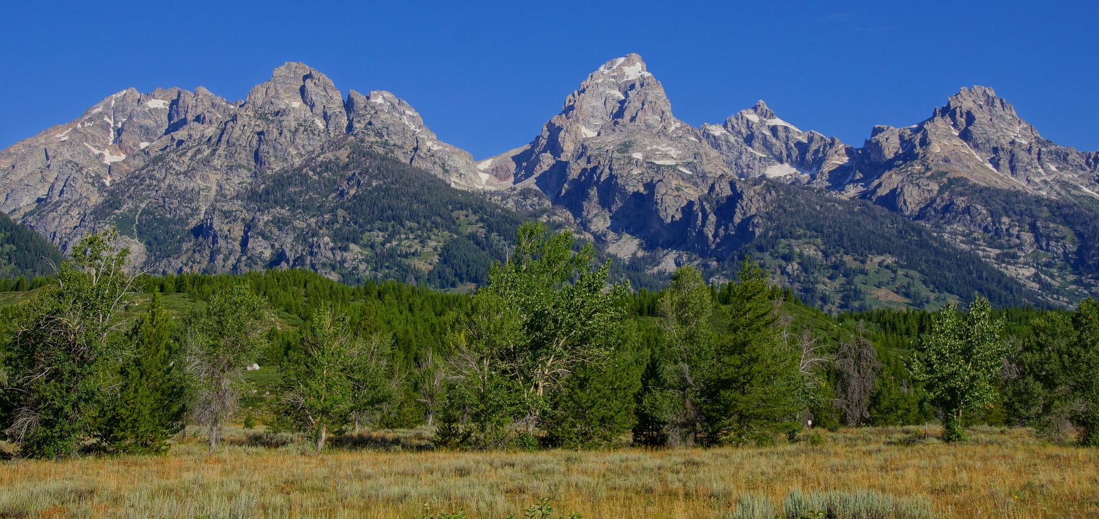
Eco-zones: sagebrush plains (foreground), sub-alpine (forest), wetland (not seen in pic-behind moraine), alpine (above the tree line)


The Teton Range (some of the oldest rock on Earth) is one of the youngest ranges in North America - thrust up 9 million years ago (Rockies - over 70 million years ago).

Overflow from the lake created a stream that ran down the hillside along most of our hike. It was pretty (not especially photogenic), but the real treat was the sound of the stream as we were hiking.

The lake was beautiful. It was nearly perfectly still reflecting the mountains and forest behind it like a mirror. In some of the pictures, it is evident just how clear the water was.


Zoe left us at the lake with several options for our return trip. We chose to return along the same trail we took up to the lake because there were several photo ops we skipped to keep up with the group.
As we were hiking back down from the lake, we noticed the clouds (along with a bit of thunder) that were blowing in from the west over the mountains started to get a little angrier and dark. We just ignored them and continued on.

I was leaning toward Blue Penstemon, but the leaf says no. Any ideas?

This stand of Quaking Aspen will be spectacular (golden glow) in a month or two. They are connected underground by spreading root systems (all one organism) and therefore all change color at the same time.

Looking back over our shoulder, we can see the storm a-comin'.

This cow moose was following the creek on the hillside, nowhere near a marshy area. So this is where they are when the sun is high!
Back at the car, there was a lot of commotion near the parking area. Sure enough, there was another cow moose. This one ambled by a creek just below the roadside and it was not alone - there was a calf moose in the brush with her

Mama moose was causing quite a car jam. Her baby was camera shy.
On the road back to the campground, we saw more bison crossing the road. One posed in front of the sign below just so it would be clear he was a wild and dangerous guy!

Bison or Buffalo!!! Wiki tells me they have been called American Buffalo longer (since 1625) than they have been called Bison (since 1774).
Bison are among the most dangerous critters in U.S.
Although the sky became completely overcast and dark, it never rained. We decided not to push our luck any further though and spent the afternoon editing our pictures and catching up on the blog.

No comments:
Post a Comment